Fairly recently, Friends of the Earth (FoE) published a map of places in England that they have determined to be potential sites for woodland establishment. When asked, they kindly provided the data in the form of a GIS vector shapefile (290 k polygons) that has allowed me to look at what this expanded woodland could look like in Cumbria. The maps below are a few examples of how the data can be mapped to indicate potential new areas of woodland in Cumbria

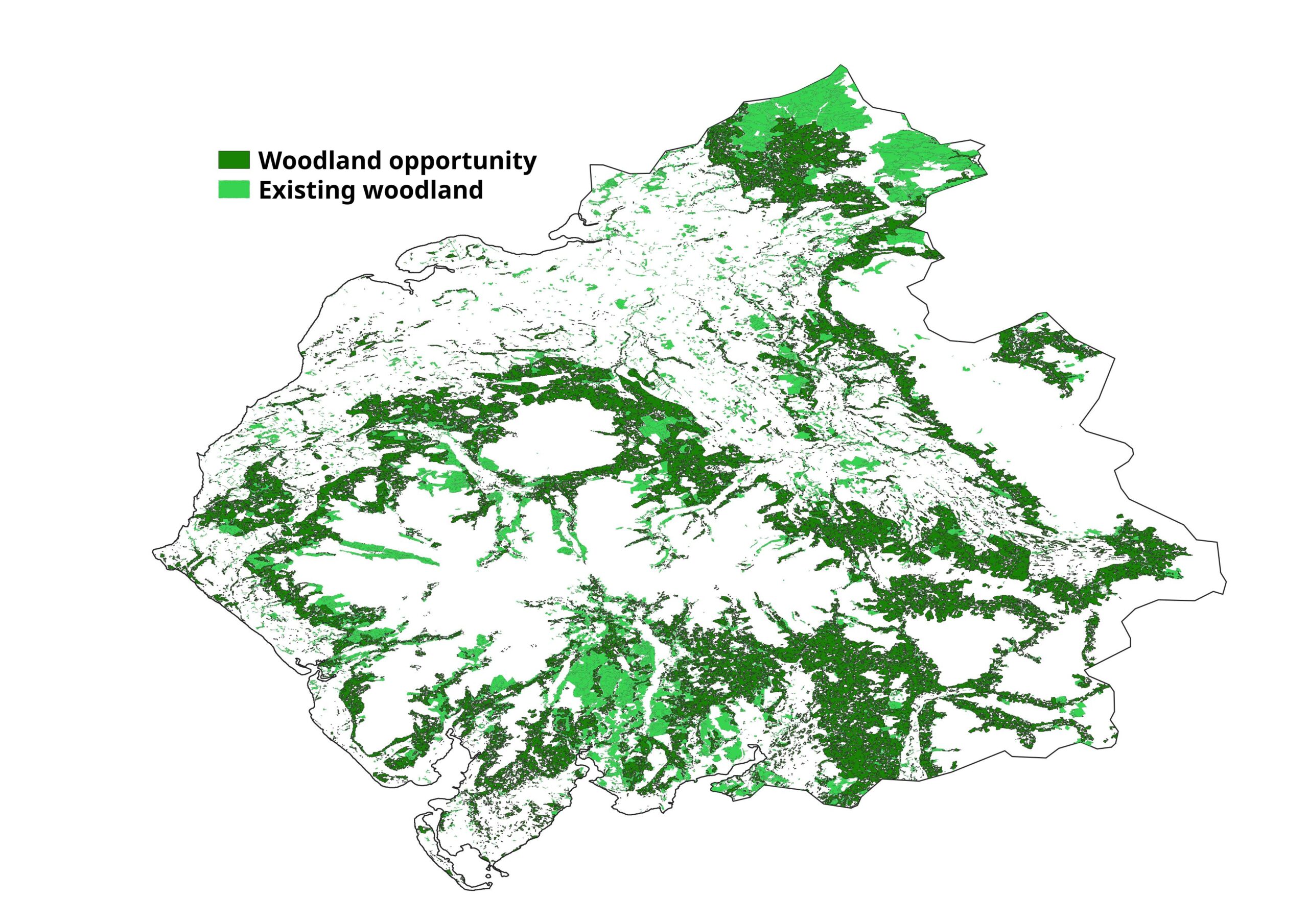
This map shows the areas of woodland opportunity alongside areas already growing trees. The current coverage of woodland in Cumbria is around 12-13% and, if fully enacted, this value would rise to around 30%.

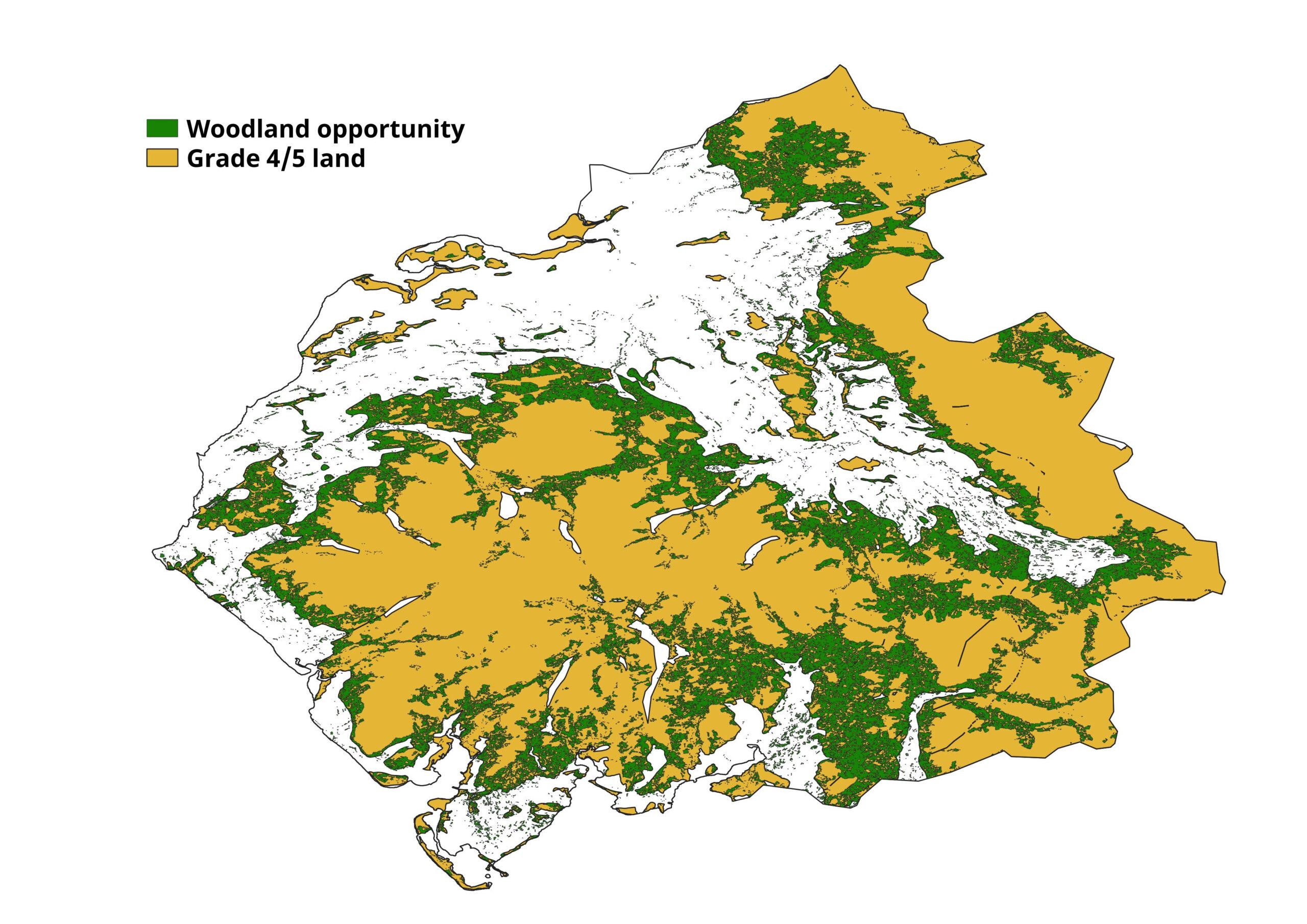
The areas that are identified as being of potential for planting (or allowed to grow up naturally) are mostly to be found within low quality land areas (grade 4-5) in the zones where the enclosed farmland meets the moorland (fell).

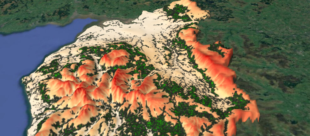
When an elevation model is used to generate a 3D representation of the county it can be seen that much of the proposed woodland areas lie on valley sides in the zone between 200 and 300 m with a few areas to the east of the county at between 300 and 500 m. To the south of Cumbria there are some lower lying areas that are indicated as potential woodland sites.
Whilst the woodland opportunity map is aspirational in nature, it does give a good idea of where we could/should be putting the trees that need to be grown if the UK is to get anywhere near carbon neutral by 2050. The criteria used to generate the map are described by the FoE and it would appear that the areas of woodland opportunity have been logically sited (in terms of elevation, land type, terrain etc.). The avoidance of all grade 5 land on the erroneous assumption that it is all peatland is, however, somewhat spurious. To enact such a level of tree planting does, however, require that some very obvious obvious practicalities are addressed, not least of which are the needs of the farmers and landowners.
For those interested in this data the full map (from FoE / Climate action) can be found here. The data can be requested.
If anyone is interested working with these maps, or producing maps derived from the data, please feel free contact me (contact details below).
